This page provides a general overview of historical, recent, and projected climate. Template maps and timeseries of changes in temperature, precipitation, and other climate variables are available for use in reports or other documents. Additional topics include the El Niño Southern Oscillation (ENSO) and Arctic sea ice. Each section has links to pages within Climate Reanalyzer where maps and timeseries can be reproduced.
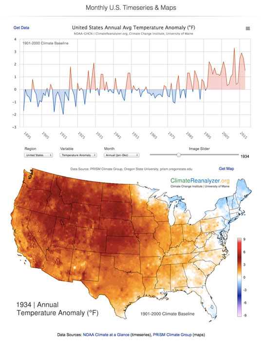
View U.S. and state-level temperature and precipitation data for annual, seasonal, and monthly means. Timeseries and maps are displayed on the same page; maps update as the cursor is passed over the timeseries. Comma-delimited (CSV) spreadsheet files can be downloaded to make custom plots in external software.
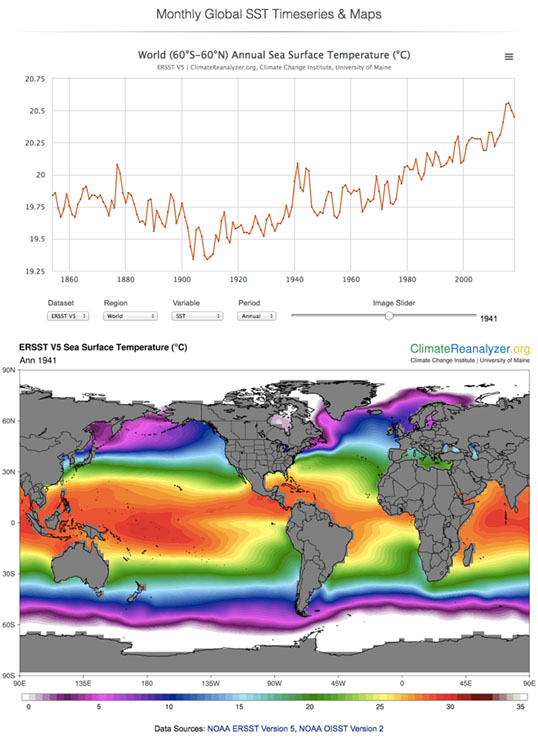
View global sea-surface temperature data for annual, seasonal, and monthly means. Timeseries and maps are displayed on the same page; maps update as the cursor is passed over the timeseries. Comma-delimited (CSV) spreadsheet files can be downloaded to make custom plots in external software.
View U.S. and state-level temperature and precipitation data for annual, seasonal, and monthly means. Timeseries and maps are displayed on the same page; maps update as the cursor is passed over the timeseries. Comma-delimited (CSV) spreadsheet files can be downloaded to make custom plots in external software.
View U.S. and state-level temperature and precipitation data for annual, seasonal, and monthly means. Timeseries and maps are displayed on the same page; maps update as the cursor is passed over the timeseries. Comma-delimited (CSV) spreadsheet files can be downloaded to make custom plots in external software.
View U.S. and state-level temperature and precipitation data for annual, seasonal, and monthly means. Timeseries and maps are displayed on the same page; maps update as the cursor is passed over the timeseries. Comma-delimited (CSV) spreadsheet files can be downloaded to make custom plots in external software.
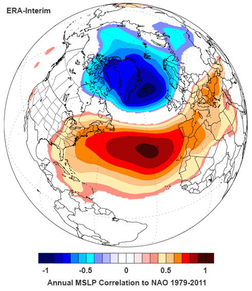
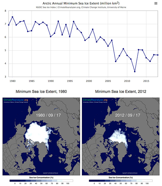
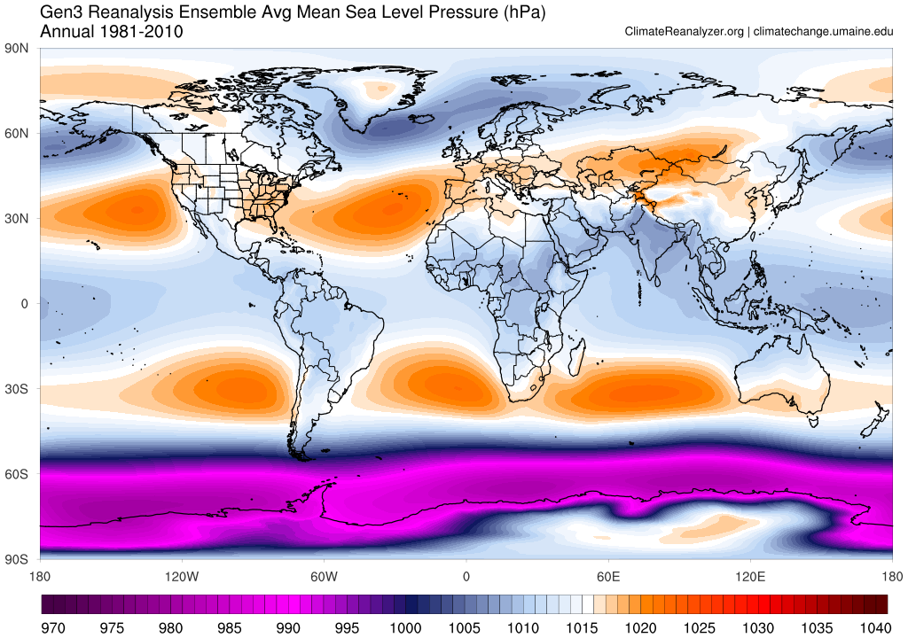
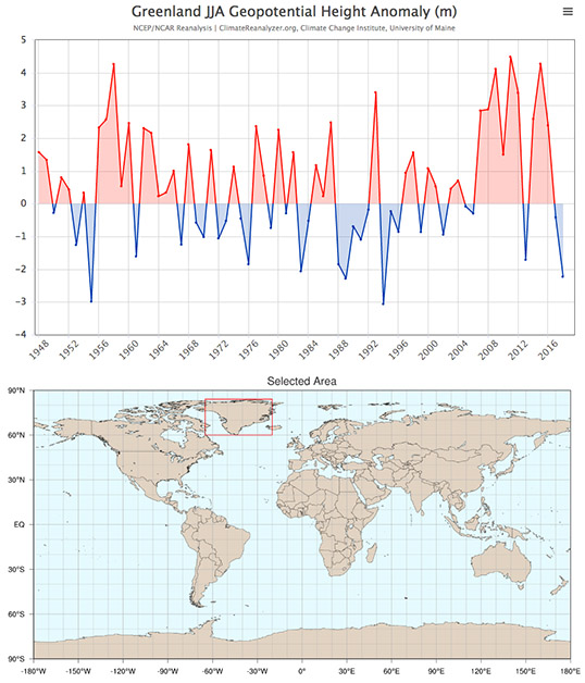
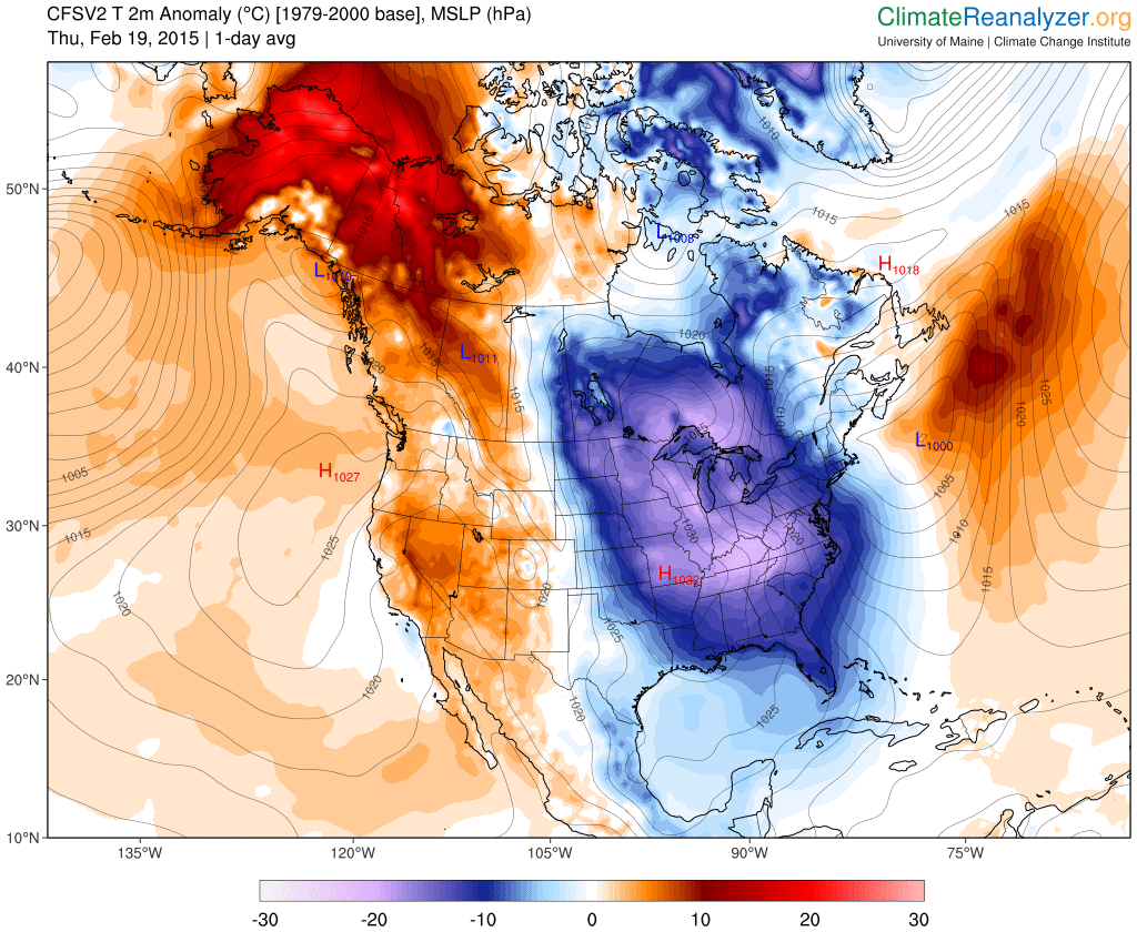
View daily mean weather maps beginning January 1, 1979-present for several climate variables, including temperature (min, max, and average anomaly), precipitation, mean sea level pressure, sea surface temperature (and anomaly), and sea ice concentration. Map domains include the world, Arctic, Antarctic, and North America.
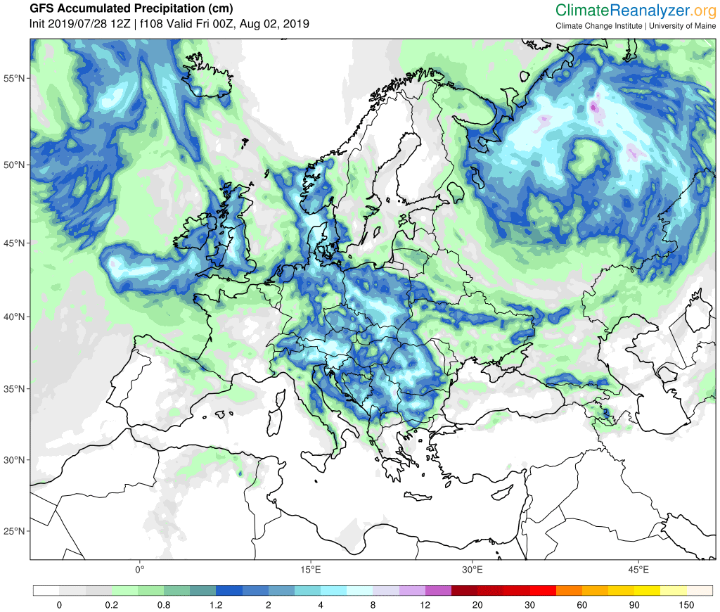
View global and regional weather forecasts from state-of-the-art operational models. Variables include temperature, precipitation, wind (near surface and jetstream), mean sea level pressure, sea surface temperature, ground level ozone, and fine particulate matter, among others. Maps are available for several domains. an archive of more than a year is available for most variables.
Climate Change Institute
University of Maine
Orono, ME 04469-5790
Tel: 207-581-2190
Fax: 207-581-1203
contactcci@umaine.edu
This work was supported by grants from the
Russell Grinnell Memorial Trust